News
Dubai: You Will Spot Apple Vehicles On Roads From Monday

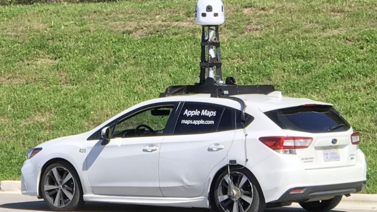
As a part of the rebuilding of Apple Maps, the residents of Dubai will be able to see Apple vehicles roaming around the city from the 24th of April onwards. Apple has been traveling millions of kilometers in the past few years in vehicles packed with high-tech image and LIDAR (remote sensing method – Light Detection and Ranging) capturing equipment, in order to reconstruct the map of the entire planet completely.
Apple Maps is all set to survey the emirate of Dubai in the coming days
As a part of the company’s initiative to reconstruct the maps of the whole world, Apple Maps will be surveying the entire Emirate of Dubai. The streets of Dubai will be surveyed with the help of special equipment-filled vehicles. Whereas the pedestrian-only areas of Dubai will be surveyed will the help of specifically-equipped backpacks that will help to collect information.
The Apple company is gathering information about more countries each year to keep the Apple maps updated. It has already completed the data collection in countries like Singapore, the US, Australia, Canada, and more. The updated maps of these nations have been made available to the users by the company.
This data collection drive in Dubai will help Apple company to provide users with a new map experience. It intends to provide a more improved navigation, with greater detail and more precise information about places.
Apple Maps detailed that, they are dedicated to protecting the privacy of the users while gathering the data. And they added that the photographs gathered will be censored to remove the license plates and faces before they get published.
In a statement given to a media channel, the company said that Apple Maps is conducting ground surveys across the world with the help of vehicles. This survey is aimed at collecting data so as to develop Apple Maps and support the Look Across function. It will be conducted with the assistance of equipment attached on the outside of the vehicles, and on iPads, iPhones, and or on other devices within the vehicles.
To keep the maps updated and as a part of the company’s efforts to maintain high quality, the company may revisit some places and gather data to provide accurate information.
Related Topics
🔹Mohamed Alabbar, The Billionaire Businessman Shares Iftar Meals With The Delivery Workers
🔹MoF Announces Exemption From Corporate Tax For Public Benefit Entities Under Specific Criteria
They further added that they place the privacy of the users at the top of everything and will try to ensure it in every way possible. As a means to ensure the privacy of the users, they will remove faces and license plates from the pictures published through Look Around.
Some of the pedestrian surveys conducting by the company will make use of a backpack system to gather information. This can be used directly in Apple Maps similar to the Look Around function. Whereas other pedestrian surveys employ devices to gather information for the purpose of improving the maps.
These kinds of pedestrian surveys would also serve as a support to Apple Maps by improving its facilities. It may enable Apple Maps to provide upgradation and improvement in certain locations that do not allow the passage of cars. This enhancement can be made while utilizing the same privacy protections as that of Apple Maps vehicles.